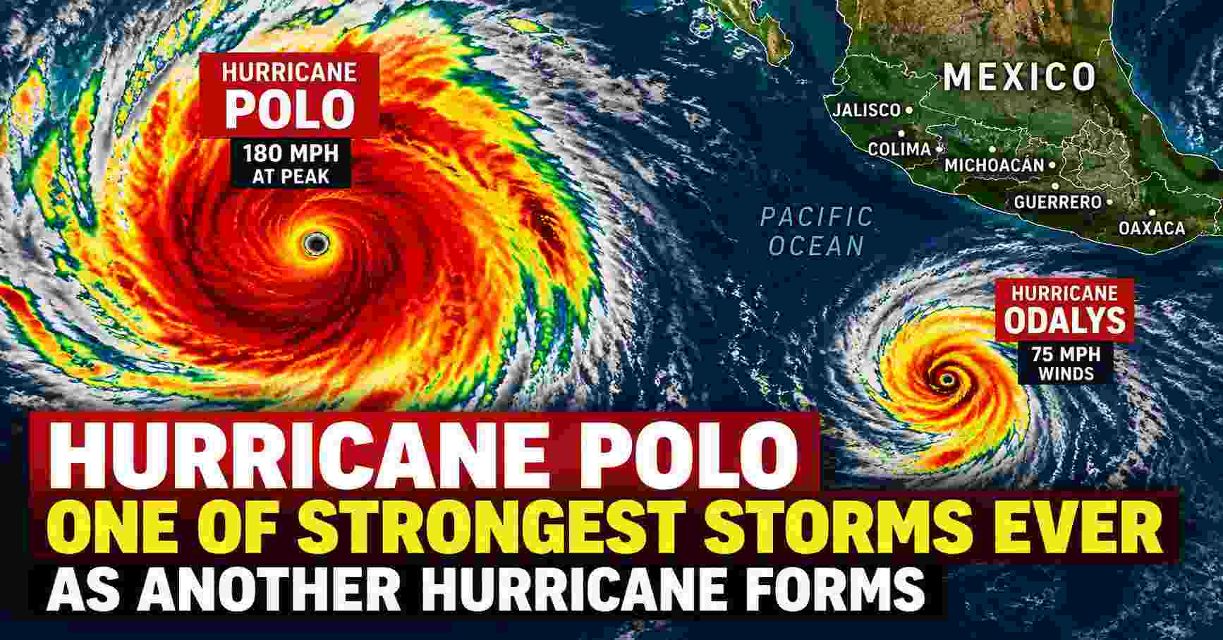
Hurricane Polo remains an exceptionally powerful storm over the eastern Pacific after reaching Category 5 intensity with winds of 180 mph, while another system, Odalys, has strengthened into a hurricane farther west. Communities along Mexico’s southwestern coast are being warned about dangerous rainfall, flooding, mudslides and hazardous surf even as Polo’s center is forecast to remain offshore.
Hurricane Polo has become one of the most remarkable storms of the 2026 Pacific hurricane season after undergoing explosive intensification off Mexico’s southwestern coast.
Polo reached maximum sustained winds of 180 mph (285 km/h) on September 22, according to observations from a NOAA Hurricane Hunter aircraft. At that time, its estimated central pressure plunged to approximately 892 millibars, underscoring the storm’s exceptional strength.
By early Wednesday, September 23, Polo had weakened somewhat but remained an extremely powerful major hurricane. The National Hurricane Center (NHC) reported maximum sustained winds of approximately 155 mph at 3 a.m. CST.
Despite the forecast keeping Polo’s center offshore, forecasters are stressing that the hurricane can still produce dangerous and potentially life-threatening conditions across portions of southwestern Mexico.
Hurricane Polo Reached 180 MPH at Peak Intensity
Polo experienced a period of extraordinary strengthening on Tuesday.
A NOAA Hurricane Hunter aircraft investigating the hurricane measured conditions supporting maximum sustained winds of approximately 180 mph, while the storm’s minimum central pressure dropped to about 892 mb.
Those numbers placed Polo firmly within Category 5 strength on the Saffir-Simpson Hurricane Wind Scale.
Category 5 begins when sustained winds reach at least 157 mph (252 km/h).
Polo’s peak intensity therefore exceeded the Category 5 threshold by a significant margin.
The NHC also observed indications that a secondary eyewall could be developing around the hurricane. Eyewall changes can cause powerful tropical cyclones to fluctuate in strength even when the overall storm remains extremely dangerous.
Polo Weakens Slightly but Remains a Powerful Hurricane
Polo did not maintain its 180-mph peak into Wednesday morning.
According to the National Hurricane Center’s 3 a.m. CST advisory on September 23, Polo was centered near 15.0°N, 101.4°W, with maximum sustained winds estimated at 155 mph.
The storm was moving slowly northward at roughly 2 mph.
Satellite imagery continued to show a distinct and well-defined eye, although the thunderstorms surrounding the eyewall were not as intense as they had been during the previous 24 hours.
Forecasters also detected signs of a possible double-eyewall structure.
Although additional fluctuations in intensity are possible, the NHC expects Polo to remain a powerful hurricane for several days as it gradually moves away from the immediate coast.
Is Hurricane Polo Heading Toward Mexico?
The current forecast does not show Polo’s center making a direct landfall in southwestern Mexico.
However, that does not mean coastal communities are free from danger.
Polo’s outer rainbands have already been reaching portions of Mexico’s southwestern coastline. Tropical-storm-force winds have also been detected just offshore.
The hurricane is expected to move generally west-northwestward as its forward speed gradually increases.
Because Polo has been moving very slowly near the coast, prolonged rainfall represents one of the biggest threats to Mexico.
Tropical Storm Warning Issued Along Southwestern Mexico
A Tropical Storm Warning is in effect from Tecpan de Galeana to Punta San Telmo, according to the National Hurricane Center.
A Tropical Storm Watch extends west of Punta San Telmo to Playa Perula.
Residents and visitors in affected coastal areas should continue monitoring information from Mexico’s national and local authorities because relatively small changes in Polo’s track could influence where the strongest winds and heaviest rainfall occur.
Heavy Rain Raises Flooding and Mudslide Threat
Rainfall is expected to be one of Polo’s most serious impacts.
The NHC forecast rainfall totals of approximately 3 to 6 inches across coastal portions of Guerrero and Michoacán, with isolated totals reaching around 8 inches through Thursday.
Coastal areas of Oaxaca, Colima and Jalisco could receive approximately 2 to 4 inches of rainfall.
These totals are particularly concerning in mountainous areas.
Heavy tropical rainfall falling over steep terrain can rapidly run downhill, producing flash flooding and increasing the possibility of landslides and mudslides.
People should not assume they are safe simply because the hurricane’s eye remains over the Pacific.
Rainbands can extend hundreds of miles from a tropical cyclone’s center and produce dangerous weather well away from the eyewall.
Dangerous Surf and Rip Currents Expected
Polo is also generating powerful ocean swells that are reaching southwestern Mexico.
The National Hurricane Center warns that these swells could create life-threatening surf, rip currents and coastal flooding during the next several days.
Beachgoers, fishermen and boat operators should closely follow restrictions and warnings issued by local authorities.
Rip currents can be particularly dangerous because conditions near a beach can appear manageable even while strong currents are moving away from shore.
Why Polo Is an Exceptional Pacific Hurricane
Polo’s rapid strengthening and extremely low atmospheric pressure have made the hurricane particularly notable.
At its September 22 peak, Polo had maximum sustained winds near 180 mph and a central pressure estimated at 892 mb.
For comparison, Hurricane Patricia in 2015 reached maximum sustained winds of 215 mph and remains an extraordinary benchmark for eastern Pacific hurricane intensity.
Polo did not reach Patricia’s peak wind speed, but its intensity still places it among an exceptionally small group of powerful eastern Pacific hurricanes.
The comparison also highlights an important point: describing Polo as one of the strongest storms in the basin does not mean it is the strongest hurricane ever recorded there.
Hurricane Odalys Forms Farther West
Polo is not the only hurricane being monitored in the eastern Pacific.
Odalys strengthened into a hurricane early Wednesday, according to the National Hurricane Center.
At approximately 2 a.m. PDT on September 23, Odalys had maximum sustained winds of around 75 mph.
The storm was centered near 15.9°N, 128.4°W and moving east-northeast at approximately 9 mph.
Odalys was located far west of Mexico and was not posing the same immediate coastal threat as Polo.
Its development nevertheless means that two hurricanes are simultaneously active in the eastern Pacific.
Polo Is the Third Category 5 Hurricane of the 2026 Pacific Season
Another remarkable feature of the season is the number of extremely intense hurricanes.
Polo became the third Category 5 hurricane of the 2026 Pacific hurricane season, following Genevieve and Lowell.
Category 5 hurricanes represent the highest category on the Saffir-Simpson Hurricane Wind Scale.
Storms at this intensity contain potentially catastrophic winds, although the Saffir-Simpson category measures wind speed and does not directly measure other major hazards such as rainfall, storm surge or flooding.
That distinction is especially important with Polo because some of the most significant threats to Mexico are expected to come from rainfall, flooding, mudslides and dangerous ocean conditions rather than a direct strike from the hurricane’s core.
What Happens Next With Hurricane Polo?
The National Hurricane Center expects Polo to remain a powerful hurricane as it gradually moves west-northwestward.
The early September 23 NHC forecast kept Polo near 155 mph through Wednesday, followed by gradual weakening later in the week.
Forecast intensity was approximately:
- 155 mph Wednesday
- 150 mph Thursday
- 145 mph Thursday night
- 140 mph Friday
- 125 mph Saturday
- 105 mph Sunday
These numbers are forecasts rather than guarantees and can change as atmospheric and ocean conditions evolve.
Increasing easterly wind shear and somewhat drier air are expected eventually to contribute to Polo’s weakening.
However, Polo is forecast to remain a significant hurricane for several days.
Mexico Continues Preparations Along Pacific Coast
Authorities have been taking precautions as the hurricane passes offshore.
Ports in parts of Guerrero and Michoacán have faced restrictions, while coastal communities have been advised to monitor official forecasts and avoid dangerous ocean conditions.
The threat is particularly sensitive for areas that have experienced destructive Pacific hurricanes in recent years.
Even without landfall, prolonged rainfall can overwhelm drainage systems, cause rivers and streams to rise quickly and destabilize hillsides.
Residents in flood-prone or mountainous locations should therefore pay particular attention to evacuation instructions and emergency alerts issued by local authorities.
Hurricane Polo Latest: Key Facts
As of the early September 23 National Hurricane Center update:
Storm: Hurricane Polo
Basin: Eastern Pacific
Peak sustained winds: 180 mph (285 km/h)
Peak reported pressure: About 892 mb
Latest sustained winds: About 155 mph
Latest movement: North at approximately 2 mph
Primary threats to Mexico: Heavy rainfall, flash flooding, mudslides, strong coastal winds, dangerous surf and rip currents
Areas particularly at risk: Coastal Guerrero and Michoacán, with rainfall also possible in Oaxaca, Colima and Jalisco
Expected track: Generally west-northwestward, with the hurricane’s center forecast to remain offshore
Is Hurricane Polo Expected to Make Landfall?
Based on the latest forecast, the center of Hurricane Polo is expected to remain offshore.
Forecast tracks can change, however, particularly when a storm is moving slowly.
More importantly, a hurricane does not need to make landfall for it to cause serious impacts.
Polo’s broad circulation is already capable of sending heavy rain, strong winds and dangerous waves toward Mexico’s Pacific coast.
How Strong Was Hurricane Polo?
At its strongest observed point on September 22, Polo had sustained winds of approximately 180 mph, making it an exceptionally intense Category 5 hurricane.
NOAA Hurricane Hunter observations also indicated an estimated minimum pressure of approximately 892 mb.
The storm subsequently weakened, with the NHC estimating sustained winds near 155 mph early September 23.
This distinction is important when following a rapidly changing hurricane: Polo’s peak intensity and its current intensity are not the same.